
Washington ZIP Code Directory Coverage
Washington County's address-point service was reviewed in August 2026. The table records ZIP values and postal-community labels represented in that county data, along with the number of county address points. It is not a list of post offices or their service areas. Counts are not population, delivery volume, or proof that a ZIP lies entirely in the county. The county layer includes small and cross-boundary representations, so keeping those values visible is more accurate than presenting a closed county-only list.
| ZIP | County map representation | County postal-community value, not post office | Notes |
|---|---|---|---|
| 15004 | 1,630 address points | Atlasburg | Western county representation. |
| 15012 | 648 address points | Belle Vernon | Partial or cross-county postal area possible. |
| 15019 | 1,344 address points | Bulger | County source value. |
| 15021 | 2,829 address points | Burgettstown | County source value. |
| 15057 | 1,590 address points | McDonald / MC DONALD | Capitalization variants occur in the data. |
| 15063 | 4,536 address points | Monongahela | County source value. |
| 15067 | 1,389 address points | New Eagle | County source value. |
| 15301 | 22,376 address points | Washington | Principal county-seat postal community in this dataset. |
| 15312 | 1,805 address points | Avella | County source value. |
| 15314 | 1,761 address points | Bentleyville | County source value. |
| 15317 | 19,802 address points combined | Canonsburg; McMurray | The source includes one McMurray label. |
| 15323 | 2,185 address points | Claysville | County source value. |
| 15330 | 2,867 address points | Eighty Four | County source value. |
| 15332 | 3,578 address points | Finleyville | County source value. |
| 15342 | 2,418 address points | Houston | County source value. |
| 15367 | 3,839 address points | Venetia | County source value. |
| 15419 | 1,292 address points | California | Includes 1,192 records with a blank postal-community label. |
| 15423 | 989 address points | Coal Center | County source value. |
The following continuation keeps the lower-count and edge values from the same inventory. Empty postal-code or postal-community fields also occur in the service. That is a data-quality condition, not a reason to estimate a missing ZIP or community value.
| ZIP | County postal-community label(s) represented | County address-point count | Coverage note |
|---|---|---|---|
| 15017 | Bridgeville | 86 | Small county representation. |
| 15022 | Charleroi | 107 | County source value. |
| 15026 | Clinton | 70 | County source value. |
| 15033 | Donora | 1,090 | County source value. |
| 15038 | Elrama | 101 | County source value. |
| 15050 | Hookstown | 32 | County source value. |
| 15053 | Joffre | 575 | County source value. |
| 15054 | Langeloth | 457 | County source value. |
| 15055 | Lawrence | 740 | County source value. |
| 15060 | Midway | 630 | County source value. |
| 15078 | Slovan | 530 | County source value. |
| 15126 | Imperial | 2 | Cross-county edge representation. |
| 15129 | South Park | 22 | Cross-county edge representation. |
| 15216 | Imperial | 2 | Cross-county edge representation. |
| 15241 | Pittsburgh / Upper St Clair | 142 | Cross-county edge representation. |
| 15311 | Amity | 621 | County source value. |
| 15313 | Beallsville | 167 | County source value. |
| 15321 | Cecil | 713 | County source value. |
| 15322 | Clarksville | 434 | County source value. |
| 15324 | Cokeburg | 329 | County source value. |
| 15329 | Prosperity | 520 | County source value. |
| 15331 | Ellsworth | 331 | County source value. |
| 15333 | Fredericktown | 902 | County source value. |
| 15337 | Graysville | 1 | Sparse county data occurrence. |
| 15340 | Hickory | 739 | County source value. |
| 15345 | Marianna | 822 | County source value. |
| 15347 | Meadow Lands | 337 | County source value. |
| 15348 | Millsboro | 308 | County source value. |
| 15350 | Muse | 267 | County source value. |
| 15353 | Nineveh | 1 | Sparse county data occurrence. |
| 15357 | Rices Landing | 1 | Sparse county data occurrence. |
| 15358 | Richeyville | 326 | County source value. |
| 15360 | Scenery Hill; Eighty Four | 1,162 combined | The source includes one Eighty Four label. |
| 15361 | Southview | 69 | County source value. |
| 15363 | Strabane | 384 | County source value. |
| 15364 | Sycamore | 5 | County source value. |
| 15366 | Van Vorhies; Van Voorhis | 82 combined | Spelling variants are present in the data. |
| 15368 | Vestaburg | 254 | County source value. |
| 15370 | Waynesburg | 5 | Cross-county edge representation. |
| 15376 | West Alexander | 819 | County source value. |
| 15377 | West Finley | 321 | County source value. |
| 15378 | Westland | 79 | County source value. |
| 15412 | Allenport | 203 | County source value. |
| 15417 | Brownsville | 957 | Includes records with an empty postal-community label. |
| 15427 | Daisytown | 643 | County source value. |
| 15429 | Denbo | 146 | County source value. |
| 15432 | Dunlevy | 96 | County source value. |
| 15434 | Elco | 157 | County source value. |
| 15438 | Fayette City | 93 | County source value. |
| 15477 | Roscoe | 336 | County source value. |
| 15483 | Stockdale | 225 | County source value. |
| 26062 | Weirton | 6 | Cross-state edge representation. |
Washington ZIP Codes Use Three Systems
A Washington ZIP code is a postal-delivery value, not a county or municipal boundary. The U.S. Census Bureau explains that ZIP Codes are delivery routes, while ZIP Code Tabulation Areas, or ZCTAs, are statistical approximations made from census blocks. A ZIP may cross county or municipal lines, and a valid delivery ZIP may not map neatly to a ZCTA. The county address-point layer supplies local operational values. USPS delivery verification remains the right check for a specific mailpiece.
Use the three systems for different questions: the county map point for local address context, USPS for the current delivery standard, and municipal or parcel records for jurisdiction. A map label, an older directory address, and a mailing address can differ without any of them being a mistake. The safest record trail preserves each description with its source and date.
The Census ZIP and ZCTA explanation describes the distinction between postal ZIPs and statistical geography. The Census QuickFacts county profile supplies broad Washington County context, not ZIP boundaries.
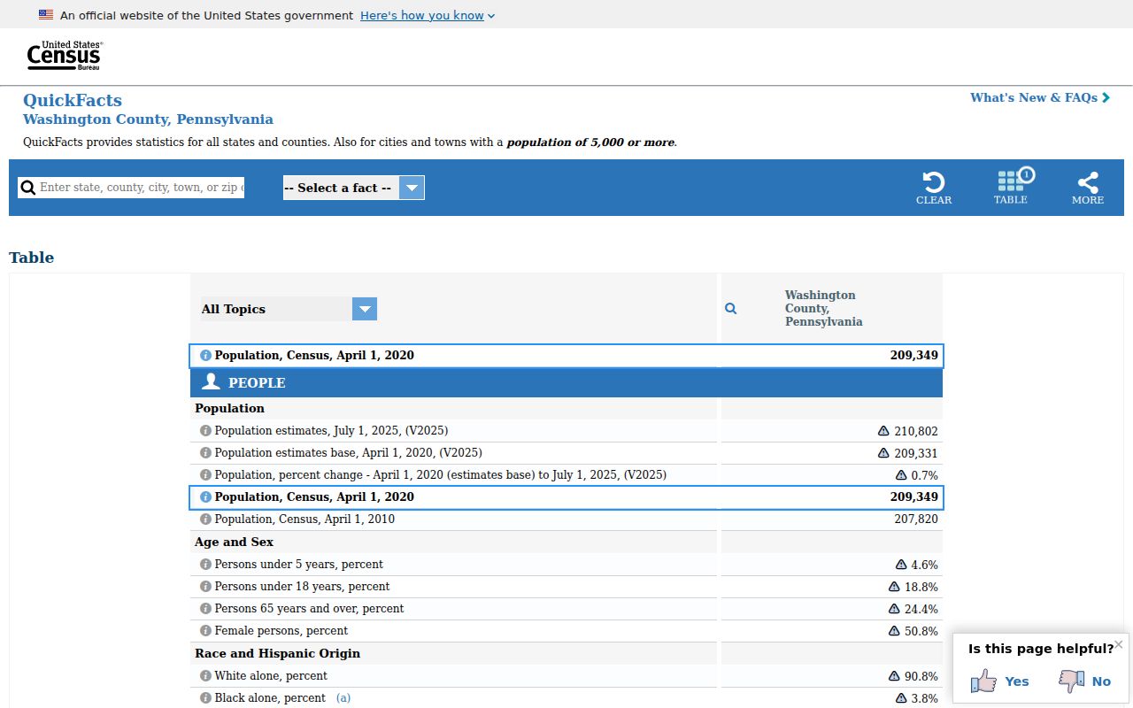
The Census context is useful for broad county geography, but it does not turn a ZIP value into a municipal boundary or a post-office service statement.
Washington Address Points Carry Postal Fields
The county address-point layer is a detailed local locator. It records physical-address pieces, postal-code fields, postal-community values, municipality and community fields, tax authority, UPI, and coordinates. It does not claim to be the legal source for ownership, a complete mailing-address card, or a delivery-address validator. A blank field must remain blank rather than being filled with an inferred suffix or community.
| Add Number | House-number component. Keep it as supplied rather than reformatting it into a guessed delivery address. |
|---|---|
| Prefix, street name, street type, suffix | Street components. Combine them only as the county source presents them. |
| Unit | Unit component. A blank value is not proof that no unit exists. |
| Post_Comm, Post_Code, Post_Code4 | County postal-community, ZIP, and ZIP+4 fields. Verify a mailpiece through USPS. |
| Inc_Muni, Uninc_Comm, Nbrhd_Comm, TaxAuth | Jurisdiction and community routing fields. They do not establish legal municipal status by themselves. |
| UPI, latitude, longitude | Parcel linkage and location fields to compare with the parcel layer and recorded-document context. |
The Washington County PASDA address-point service exposes this data dictionary.
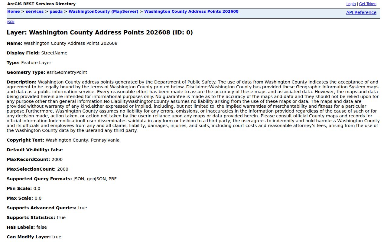
The field structure is useful for finding a county map record, then comparing that record with a parcel result and a current postal verification.
Washington ZIP Code Directory Map Counts
The largest address-point representation in the August 2026 inventory is 15301, with 22,376 points carrying the Washington postal-community label. ZIP 15317 has 19,802 points combined for Canonsburg and McMurray, with one McMurray label in the source. Monongahela's 15063 has 4,536 points. These are useful county data counts, not population totals and not a declaration that the ZIP boundaries match a city, borough, or township.
For an address research question, a high count does not make a match more certain. Narrow the result by street, municipal context, UPI or parcel identifier, and the record date. The county Parcel & GIS Viewer provides that local parcel context, while the Tax Revenue route is the place to pursue the official property record when needed.
Washington ZIP Code Directory Edge Values
Several county-layer values show why a postal label needs context. Bridgeville has 86 county address points, Pittsburgh / Upper St Clair has 142, Waynesburg has five, and Weirton in West Virginia has six. Imperial appears as two points under each of 15126 and 15216. South Park has 22. These entries are small cross-county or cross-state representations in the county dataset, not evidence of a Washington County post office or a municipal boundary shift.
Washington County's border and borough-township pattern make this distinction practical. A historic record may name a township, a current map point may carry a postal-community value, and a mailing address may use another community name. Use the municipal directory and parcel fields to identify which government has the record.
County-map context is not delivery verification. A county ZIP field helps locate a mapped address point. Confirm a current mailing address through USPS before sending a document or relying on a delivery suffix.
Washington Postal Label Variants
The address-point inventory preserves source spelling and capitalization differences. ZIP 15057 includes McDonald and MC DONALD. ZIP 15366 includes Van Vorhies and Van Voorhis. ZIP 15360 combines Scenery Hill and Eighty Four, while 15317 combines Canonsburg and McMurray. These values make good search variants when locating a county map point, but they should not be silently standardized into a claim that one form is the only correct postal label.
ZIP+4 needs the same restraint. The county service contains Post_Code4, yet individual records can be blank. A blank ZIP+4 is an unavailable attribute, not an invitation to guess a delivery suffix from nearby points or a map. Preserve the displayed value and verify it with the postal service when delivery matters.
Find Washington Records by ZIP Code
A ZIP filter can organize an address search, but it is not a people list. Start with an actual street address or parcel question. County GIS then provides the local map point, postal fields, municipality, and UPI context. The parcel route can lead to the record used for an ownership or assessment question. For a registered voter, Pennsylvania provides an individual status route, while a full voter export uses a statutory request and permitted-use affirmation rather than a public ZIP-by-ZIP browse tool.
- Enter the full address in the county Parcel & GIS Viewer or use its address/place search, then retain the ZIP, municipality, and mapped parcel context.
- Compare the point with Post_Code, Post_Code4 when present, Post_Comm, and the Incorporated Municipality or tax-authority fields.
- Verify the mailing address with USPS before using it for delivery. Do not estimate a ZIP+4 or replace a blank county field.
- For a property question, follow the county property or Recorder route using the PIN, legal description, or recorded-party details that fit the record.
Once the address is narrowed, the Washington street directory has the address-focused property and deed workflow. A ZIP alone should never be used to claim who occupies a parcel.
ZIP Code Boundaries and Washington Jurisdictions
Municipal and postal geography should remain separate. County fields such as Inc_Muni, Uninc_Comm, Nbrhd_Comm, and TaxAuth can route a local records question, but they are not a legal municipal finding by themselves. Pair the selected address point with the parcel map, tax authority, and the Washington County Municipal Directory when the correct borough, city, or township matters. For land, a legal description and recorded instrument are stronger than a postal label.
- ZIP Code and ZCTA
- A ZIP Code supports postal delivery. A ZCTA is a Census statistical approximation and is not a postal-service boundary product.
- ZIP+4
- An added delivery-segment suffix. It should be verified, not derived from a county map record or a nearby address.
- PO box ZIP
- A ZIP used for post-office-box addressing. The county inventory does not establish which local ZIPs have that status.
- Unique ZIP
- A ZIP assigned to a single organization in some places. The county inventory does not establish any local unique ZIP.
- Carrier route
- A postal delivery grouping. It is different from a municipal boundary, a parcel, and a population area.
Verify a Washington ZIP Code Address
For a reliable address record, perform each check in its own system. Find the county map point for local components and coordinates. Verify the delivery address with USPS. Confirm the jurisdiction with the parcel map and municipal directory. If a historic deed or directory uses another address form, retain that older form alongside the current one and use the legal description, plan, PIN, or municipal context to connect them. No verified county database supplies a complete historical address-to-ZIP change record.
Note: A ZIP or postal-community value is a useful locator, but it is not proof of municipal residence, parcel ownership, or a current delivery address.