
Sources for Washington Previous Residents
The strongest address history combines a land trail with a household trail. Start with the era you need, then choose the source that was created near that date. A current GIS result gives a modern parcel position and identifiers. A deed identifies parties to a land transaction. A directory or census can capture a dated household clue. Previous residents require this source-by-source approach because no one record establishes every person named at the property across time.
| Source | Years It Covers | Where Held | What It Shows |
|---|---|---|---|
| Recorder deed records | 1781-present, per county statement | Landex and Recorder office | Instrument chain, parties, legal description, and recording references |
| County GIS and assessment routes | Current system | County GIS and Tax Revenue | Current parcel position, PIN, and recent assessment context |
| POLK and WASHINGTON directories | 1899-present, with some years missing | Citizens Library | Year-specific adult or address listing route |
| Washington newspapers | 1808-Feb. 2018 across listed runs | Citizens Library | Notices, obituaries, address, and event clues |
| Federal census | 1790-1930, except 1890 | State Archives and National Archives channels | Released household, date, and place evidence |
| Washington Sanborn map | Nov. 1891, eight sheets | Library of Congress | City street and building context |
| Probate and Orphans' Court material | Records back to 1781 in WCHS scope | Register, Clerk, and WCHS | Estate, will, fiduciary, and heir trail subject to access rules |
For an address that sits outside the City of Washington, the 1891 Sanborn set is not the answer. Favor the legal description, municipality, parcel layers, and local historical collections instead. The city map is a dated built-environment source, not a countywide occupant list.
Start With a Washington Parcel
Washington County's Parcel & GIS Viewer is the practical starting point for a present-day address. Its configured search routes include Parcel Search Attribute, Owner Name 1, Owner Name 2, and an address/place geocoder. Select the mapped feature, then preserve the PIN, PINnoDash, MCN, municipal/PIN combination, and displayed location. The map search is a locator, not a legal conclusion. Its name searches are configured for partial matching, so a result set may need to be narrowed by parcel, municipality, or map position.
The correct current-record sequence is address or place, selected parcel, PIN, then the county property and Recorder routes. Tax Revenue links the assessment and property-record access paths. A physical situs address describes the parcel. A mailing address, where one is available on an official card, can serve a different purpose. Do not treat either field as proof of a person's residence. Preserve modern PIN information as a finding aid when the older record uses lot, block, plan, acreage, boundary calls, or subdivision language instead.
Note: A current parcel layer does not publish a verified historical address-change chronology for Washington County.
Trace Washington Deed Chains Backward
The county says all deeds from 1781 to the present are remotely available through Landex. Begin with the current owner shown through the county property route and search that party as a grantee, the person receiving an interest, to find the acquisition instrument. Record the instrument number or book and page, recording date, parties, legal description, and any prior-deed reference. The seller or transferor is the grantor. Search that grantor as a prior grantee only after checking that the land description still matches the same property.
- Use GIS to record the current address, municipality, mapped parcel, PIN, and legal-description clues before opening a deed index.
- Find the current owner's acquisition as a grantee and copy the recording reference, instrument type, and legal description.
- Identify the grantor on that instrument, then search that party as a grantee for the earlier acquisition.
- Recheck lot, block, plan, acreage, boundary calls, municipality, and cited prior instruments at every step, especially after a split or merger.
- When an older citation does not resolve online, use the Recorder's public computers or staff route rather than guessing an address match.
- Grantor and grantee
- The grantor transfers an interest; the grantee receives it. Those roles belong to a particular recorded instrument.
- Chain of title
- A documented sequence of recorded land transfers for the same property, checked record by record rather than inferred from names alone.
- Legal description
- The lot, block, subdivision, metes-and-bounds, or comparable land wording that identifies property more reliably than an older street label.
- PIN
- A county parcel identifier useful for locating a current map feature. It may not appear in historic deeds and should not be projected backward as if it did.
Washington Landex Index Route
The Recorder of Deeds identifies Landex as the county-designated remote deed route and also provides public computers at 95 West Beau Street. Landex WebStore supports an occasional document search. County, instrument type, municipality, name, recorded date, book/page, and instrument number are documented search capabilities. A basic result can locate a citation, but an image order may cost. A subscription route has additional fields where a county supplies them.
Old chains are often harder than the coverage dates suggest. Variant names, older index conventions, plans, subdivision changes, split or merged parcels, and book/page references can interrupt an apparent name path. The research did not establish the substantive contents of the Recorder's Russell Index Conversion Chart, so no date cutoff or conversion rule should be assumed. When the legal description no longer aligns, pause the name chain and use the cited instrument, parcel history, and Recorder terminal path to resolve the land itself.
Washington Past Household Evidence
Land transfers identify recorded parties, not necessarily the people who lived at an address. For the household side of a Washington address, Citizens Library's directory run starts in 1899 and continues to the present with gaps. Use an alphabetic entry for an adult name, then ask whether that exact volume has a street, reverse, or criss-cross listing. The public holdings description does not promise that every annual volume contains a reverse section. The collection details and entry-reading method are available on the Washington city directory page.
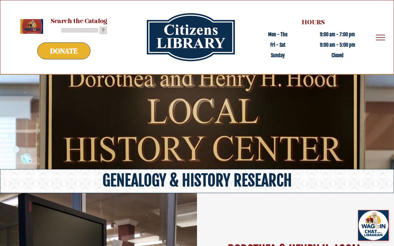
Citizens Library's genealogy collection is the official starting point for those historical holdings.
The library listing is one dated adult or address clue. Pair it with the nearest released census, which the Pennsylvania State Archives reports for Pennsylvania from 1790 through 1930 except the destroyed 1890 census. Label the evidence plainly: recorded owner on a deed, adult listing in a directory, household on a census, or estate reference in probate. That distinction prevents a past-resident search from overstating what a single source can establish.
Washington Newspapers and Probate
Newspapers can bridge the space between editions. Citizens Library reports the Washington Reporter from August 1808 through April 1967, the Washington Observer from January 1872 through December 1969, and the Observer-Reporter from January 1970 through February 2018. Its Claysville Recorder run is 1894-1973, and its McDonald Record Outlook run is 1892-1983. An obituary or notice can point toward an estate, a family connection, or a date to test in another record. It does not establish current occupancy.
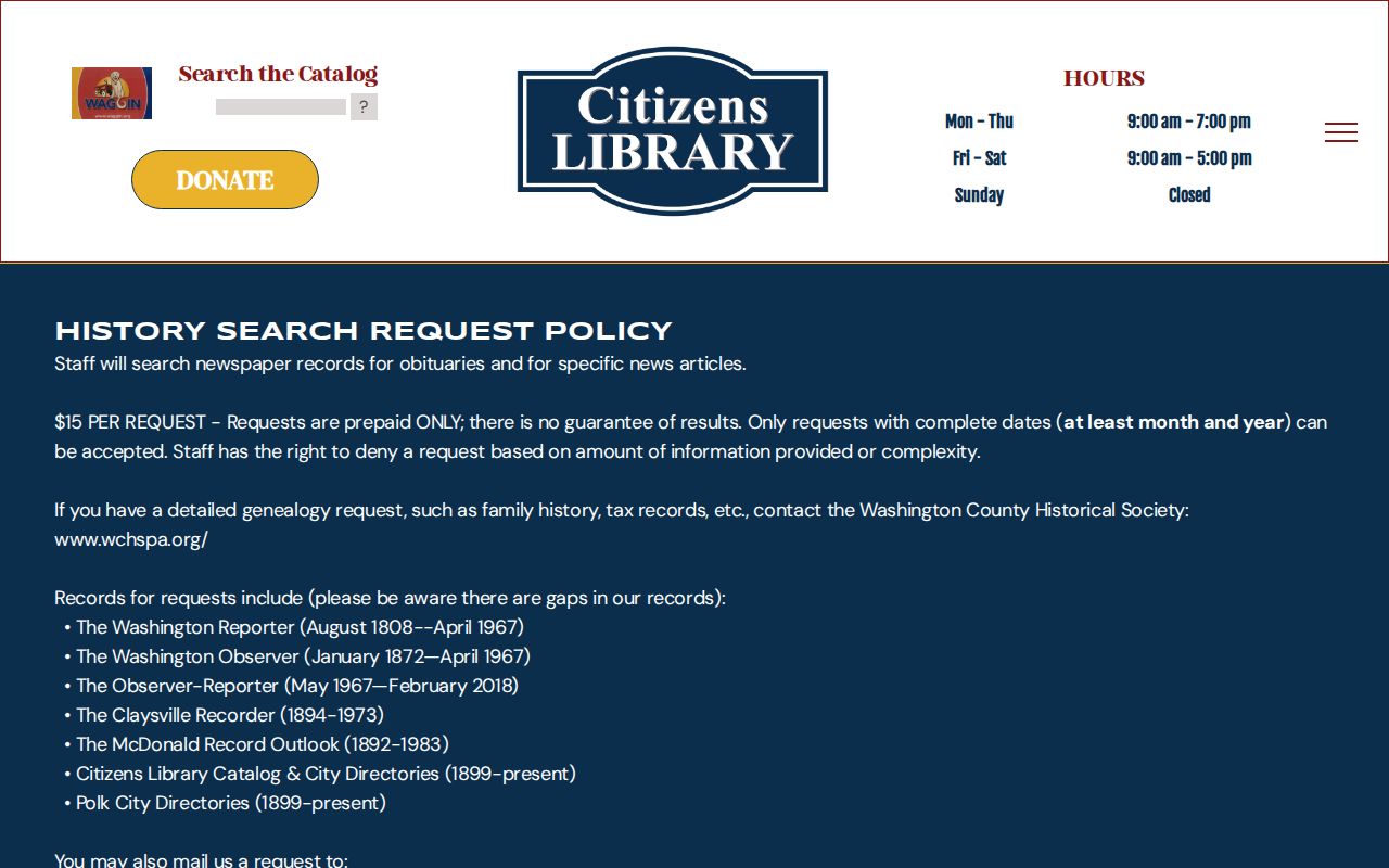
Citizens Library's history-search request information describes a $15 prepaid, date-specific directory or newspaper search and warns that a result is not guaranteed.
Probate can supply a separate endpoint. The Register of Wills and Clerk of the Orphans' Court handle wills, estate administration, guardianship and related court filings, while the Washington County Historical Society reports research access to deeds, wills, and Orphans' Court material back to 1781. The Norma K. Grimes Research Library is at 48 East Maiden Street, by appointment Tuesday through Friday from 11 a.m. to 4 p.m. Its published nonmember research rate is $20 per hour with a four-week estimate, plus a short initial allowance; recheck published rates and copy terms before requesting service.
Washington Maps Across Time
The Library of Congress Washington Sanborn set is a November 1891 view of city streets and building footprints across eight sheets. It can help compare a historic directory street reference with present-day mapping, but it does not list occupants, establish ownership, or cover the entire county. Use it to describe the built environment only. The county GIS viewer supplies current parcel and address-layer context, so the two sources are complementary rather than interchangeable.
There is no sourced countywide or City of Washington street-renumbering or renaming chronology in the research. Do not claim one. Street form, postal community, municipal boundary, ZIP, and house number can differ between historic and current records. Preserve the old form exactly, then use a deed legal description, local map, municipality, and dated library material to test a connection. A present map label alone is not enough to rewrite a historic address.
Washington Before County Formation
Washington County was formed from Westmoreland County on March 28, 1781, with Washington as county seat. For an event before that date, begin with the predecessor-jurisdiction question rather than expecting a Washington County deed, probate, court, tax, or local-government record. The Washington County Historical Society reports deed, will, and Orphans' Court research scope beginning in 1781, while the Recorder's remote deed statement also begins at 1781.
The time sequence has other breaks. Pennsylvania's federal census schedules are released through 1930, but the 1890 census was destroyed. Citizens Library directories begin in 1899 and have missing volumes. Those limits make an evidence ladder more reliable than a straight narrative: county formation and land records, then maps, directory editions, newspapers, released census, probate, and current parcel information. Each rung has its own date range and conclusion limit.
Washington Dated Record Limits
A historical document is not proof that someone currently lives at the address. A recorded deed party may be an owner, seller, or other participant in a transfer. A tax or homestead record is an administrative or program fact, not a census of everyone at a parcel. A directory and census are dated listings. A probate file may identify an estate, heir, fiduciary, or court matter. Keep those labels in the address timeline and do not convert them into a present-residence claim.
Lawful use. Washington house-history research is for family history, estate questions, property context, and personal curiosity. Do not use historical records to stalk, harass, threaten, or track a living person.
When a record appears wrong, preserve its official URL or source, document number, PIN, case reference, and date viewed, then contact the agency that maintains that record. The Recorder handles recorded-document questions; Tax Revenue handles parcel-data questions; a court clerk handles court-file access. Careful correction starts with the proper custodian, not with assumptions drawn from a past-resident trail.
Note: Dated documents support dated conclusions, not a finding of present occupancy.