
Walking a Washington Street by Address
A Washington street directory works best as an address-record workflow, not a list of people. Begin in the county Parcel & GIS Viewer with the address or place search. Confirm the selected parcel geometry, note its PIN, PIN without dashes, MCN, and municipality, then compare a nearby address point. Use that parcel context to open the county property route or, where a recorded transfer matters, to search Landex with the owner name, municipality, recorded date, and available parcel or citation details. Preserve every result as a separate record type.
- Use the GIS address or place search and select the returned map feature.
- Keep the parcel layer visible and copy the PIN, municipal context, and map date exactly as shown.
- Check Tax Revenue or the assessment route for current administrative property context, without treating an owner field as an occupant list.
- Search the Recorder's Landex route for a dated instrument using party, municipality, recorded-date, book/page, or instrument details.
- For an earlier household, pair a dated library directory or newspaper with the historical address rather than applying current GIS labels backward.
The Pennsylvania voter status page is an individual's self-service route, not a street-by-street public roll. A full voter-file request follows a separate statutory process and permitted-use affirmation. It should not be used to turn a street search into a roster.
Washington Street Map Search Fields
The official Parcel & GIS Viewer offers two kinds of Washington street search. Its general geocoder accepts an address or place. Its parcel layer has partial-match fields for Parcel Search Attribute, Owner Name 1, and Owner Name 2. A partial owner search may return several parcels, so use the street directory result only after checking map position, municipality, and parcel identifiers. The viewer also supplies layer, measurement, draw, and coordinate controls. Those are visual tools, not a documented legal-boundary or radius query.
| Washington viewer field | Type | Street-directory use |
|---|---|---|
| Search for parcels or address | Text and autocomplete | Start with a parcel or address-place result. |
| Parcel Search Attribute | Partial-match text | Find parcel-boundary records without assuming an exact street match. |
| Owner Name 1 / Owner Name 2 | Partial-match text | Locate candidates, then narrow by map and parcel details. |
| ArcGIS Address or Place | Autocomplete text | Locate a map starting point in the United States configuration. |
Washington County GIS provides the county mapping route represented in this capture.
The image is a useful reminder to preserve a selected feature and its layer rather than relying on a street label alone. A road centerline or address point may not sit on the parcel boundary at map scale.
Washington Address Components Matter
The county address-point service records operational address components separately. Its documented attributes include Add Number, directional and street elements, Unit, Post_Comm, Post_Code, Post_Code4, incorporated and unincorporated community values, neighborhood or community, TaxAuth, UPI, and coordinates. A blank unit or ZIP+4 is an unavailable layer value, not permission to fill in a missing piece. Preserve prefixes, suffixes, and community spelling as the service supplies them.
- Parcel
- A county-mapped piece of land associated with a current PIN and geometry.
- Situs address
- The physical location of the parcel, which can differ from an owner's tax mailing address.
- Plat
- A recorded plan or map that can help identify land, roads, lots, or subdivision context.
- Criss-cross directory
- A reverse or street-oriented directory section, when a particular historic volume actually includes one.
ZIP Codes are managed for delivery, while Census ZCTAs are statistical approximations. Use USPS for a specific mailpiece, the county layer for local map context, and the municipal directory or parcel layer for local-government routing.
Washington Owners Are Not Street Occupants
A Washington parcel record can support a carefully limited statement about the parcel, owner fields as displayed, and tax or assessment context. It cannot establish the complete household at an address. A situs address identifies land. A mailing address can be somewhere else. A recorded deed establishes an instrument and parties, not a current household. The distinction is especially important when an address has a business mailing address, a split parcel, multiple units, or an older directory form.
| Source | What it can show | What it cannot prove |
|---|---|---|
| GIS parcel layer | Parcel location, PIN, configured owner-search context | Current household composition |
| Assessment or tax route | Administrative property and tax context | Every person using the property |
| Landex deed index | Recorded parties, date, instrument references | Present occupancy |
| Historic directory | A dated listing in that edition | A current address or continuing residence |
Note: Keep the source date beside every Washington street directory finding so an older record is not presented as a current one.
Washington Street Deed Trail
Once the parcel route supplies context, the Recorder's Landex access is the county's documented route for deeds from 1781 to the present. Search the party associated with the current acquisition as a grantee, capture the recorded date, instrument type or number, book and page, municipality, legal description, and cited prior deed, then search the seller as a prior grantee while checking the same land description. When a current street number is absent from an older deed, lot, block, plan, acreage, boundary calls, and municipality are better bridges than a guessed address match.
Landex WebStore is the county-designated occasional-search route.
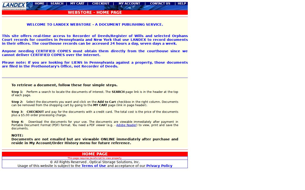
WebStore images require an order, while the Recorder's public computers and staff contact are the documented recovery channels when an older citation, conversion convention, or image cannot be resolved remotely.
Washington Street Records by Address
Address-keyed Washington records are most reliable when each source stays in its lane. The map uses the parcel as a geographic anchor. Tax Revenue maintains assessment and transfer-analysis work. The Recorder preserves land instruments. City administrative files may be routed through the City Clerk. Historic sources preserve a particular dated view of a street. The table gives the route and the limit together, so a street directory search does not turn map, tax, and history data into one unsupported resident claim.
| Washington address source | Keeper | Street-level value | Access and limit |
|---|---|---|---|
| Parcel and GIS Viewer | County GIS | Parcel geometry, PIN, map layers, address context | Free viewer; informational, not survey or title evidence |
| Address-point service | County GIS/PASDA | Address parts, postal fields, municipality, UPI, coordinates | Public service; no ownership or residency conclusion |
| Assessment and tax route | Tax Revenue | Property, assessment, claims, and current tax context | Portal or counter; update schedules vary |
| Deeds and plans | Recorder / Landex | Parties, dates, citations, legal descriptions, images when ordered | Remote 1781-current deed route; image access may cost |
| City permit or code file | City Clerk / code custodian | Responsive address-keyed municipal material | No verified public search portal; make a narrow RTKL request |
| Sanborn map | Library of Congress | 1891 City of Washington street and building context | Not countywide and not an occupant record |
Tax Revenue links the county's Property Records Public Access Site and Parcel Viewer. Its assessment work includes deed-transfer analysis, map maintenance, permit review, and assessment-change notices.
Washington County Tax Revenue is the official route shown in this capture.
Follow its property-access links or use the office counter when the public GIS result does not expose the needed assessment detail. Do not claim a field was displayed unless the current property card actually shows it.
Washington Street History Needs Dates
For an old Washington street question, use the date before the modern map. Citizens Library holds POLK and WASHINGTON City Directories from 1899 to the present with gaps, along with overlapping newspaper runs. Ask staff whether a selected volume includes a street, reverse, or criss-cross section. The public holdings information does not promise that every annual volume has one. Citizens Library's prepaid $15 history-search option is a documented alternative when the needed directory or microfilm must be checked in house.
The Library of Congress has eight November 1891 Sanborn sheets for the City of Washington. They can show historic street names, building footprints, and local layout, but not a household roster or countywide address history. The Washington County Historical Society is another appointment-based research route for deeds, wills, Orphans' Court material, newspapers, and surname or vertical files. No authoritative county online street-name-change, road-vacation, or address-history database was found in the research. Do not invent a renumbering date when a present label differs from an old source.
Note: Retain the old spelling, edition year, municipality, and source page or image before connecting an historic street reference to a modern parcel.
Washington Street Jurisdiction Check
Washington County has 66 municipalities, and a postal community does not answer which city, borough, or township maintains a local record. After selecting a parcel, compare its incorporated-municipality and tax-authority context in the county tools, then use the county Municipal Directory to find the responsible local government. For a City of Washington permit or code matter, the City Clerk's Right-to-Know route is the documented channel. A county request will not necessarily reach a city file.
For a visual surrounding-parcel question, retain only the parcels visibly selected near the target at the stated map scale. The viewer has drawing and measurement controls but no documented standard output for everyone within a set radius. The immediate-block approach is handled separately in the Washington neighbor lookup.
Washington Street Results Need Dates
Keep a short source log for each Washington street directory search. Record the question, the official URL, access date, exact query, selected PIN, municipality, map layer, and the fields actually displayed. For a Recorder result, add the party name, recorded date, instrument number or book and page, and whether an image was ordered. For a City request, keep the address, date range, and the specific permit, code, or administrative record sought. A log makes it possible to revisit a map result after the county updates its parcel or address-point service.
The county's GIS and PASDA material identifies an August 2026 refresh for the address-point service and a parcel date marker of 20260816. These are dataset-version details, not a promise that an image depicts every current change. If a current map label conflicts with an old deed or directory, retain both forms and use the legal description, plan, municipality, or cited instrument to investigate the connection. Do not silently replace an older address with a modern delivery form.
Limits of a Washington Street Directory
The Washington street directory can locate a parcel, show a recorded land event, or place a household in a dated historical source. It cannot provide a complete current household list. Parcel ownership, tax mailing information, a map address point, visual adjacency, and a historical directory entry all describe different things. They should not be merged into a claim about who lives at an address now. Court, voter, correctional, and Address Confidentiality Program rules can further limit public access.
For an error in a parcel or assessment record, contact the agency that maintains it. For a land-description or title question, obtain the relevant recorded instrument or plat through the Recorder and seek appropriate professional help where the issue requires a legal boundary determination.